Msasa Infrastructure Router
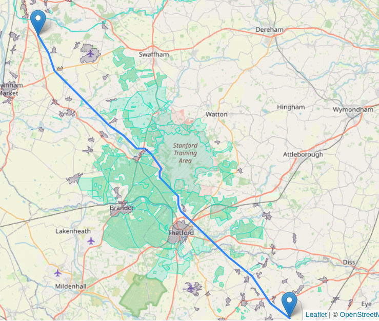
A route found by MIR, picking it's way through the urban areas in grey and SSSIs in green.
A route found by MIR, picking it's way through the urban areas in grey and SSSIs in green.
The Msasa Infrastructure Router (MIR) is a geospatial routing algorithm that can find an optimal route for infrastructure across open spaces considering cost layers and polygons on a map.
MIR is capable of finding the least cost path between two points on both land and sea, taking into consideration the layers on the map e.g. urban areas, utilities, conservation areas.
The Infrastructure Router finds smart routes for linear infrastructure (e.g. power lines, pipelines, road, rail, irrigation) across a map. You input the start and end points as well as the relative cost to cross through each layer compared to crossing open ground.
Civil engineers, infrastructure developers and planning authorities will benefit from using MIR to model engineer competing routes for projects and proposal quickly and cheaply.
Sign up now to try it out Sign-up
For subscriptions, partnerships, queries and suggestions drop us a line at: